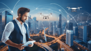
The Future of Urban Design: Reducing Noise Pollution with Drone Technology and Digital Twins
July 29, 2024
Imagine living in a bustling city where the constant noise from traffic makes it difficult to find peace and quiet. Noise pollution affects not only sleep but also overall well-being. Picture a future where technology helps urban planners design more peaceful, more livable cities. This vision is becoming a reality by integrating drone technology and digital twins.
The Impact of Urban Planning on Noise Pollution
Urban planning significantly influences noise pollution levels. Factors such as urban density, the layout and shape of city structures, land use, street distribution, and the presence of green spaces all play a role in the volume and distribution of traffic, the most critical source of urban noise pollution. By designing cities with these factors in mind, we can better predict, analyze, and prevent noise pollution.
For instance, higher urban density can lead to increased traffic congestion, exacerbating noise levels, and the strategic placement of green spaces and parks can act as buffers, absorbing and reducing noise. The design of street networks also plays a role; streets lined with buildings can create canyons that amplify noise, whereas more open layouts with ample vegetation can help dissipate sound. Understanding these dynamics is essential for creating quieter urban environments.
Leveraging Digital Twins and Drone Technology
Cities are now leveraging digital twin technology to create detailed, dynamic models of urban environments. A digital twin is a virtual representation of a city that is continually updated with real-time data. This model allows urban planners to simulate and test different scenarios to find the best solutions for reducing noise pollution and improving urban living standards.
Drones play a crucial role in this ecosystem by accumulating continuous data for digital twins. Drones with various sensors can monitor real-time noise levels, traffic flow, and environmental conditions. This data is fed into the digital twin, enabling a constantly updated, accurate representation of the city.
Before the advent of digital twin technology, urban planners relied on traditional methods such as manual surveys, acoustic measurements, and traffic analysis. These methods provided valuable insights but were often limited by the data availability, the frequency of updates, and the level of detail they could offer. This kind of sporadic data collection and static models could not adapt to the rapidly changing urban environment, which has often led to delayed responses and less effective noise mitigation strategies.
Practical Applications in Urban Design
Integrating drone technology with digital twins enhances the accuracy and efficiency of noise assessments. This approach allows for more informed decision-making and better urban planning practices. Examples include building height and density, green spaces, and continuous monitoring.
Building Height and Density: Taller buildings and high-density areas can amplify noise by reflecting and trapping sound waves. Urban planners use data on these dynamics to design building layouts that minimize these effects, ensuring a quieter environment. Analyzing drone-collected data helps urban planners identify noise pollution hotspots in high-density areas, leading to targeted measures like optimizing building placement and redesigning urban spaces to reduce noise.
Green Spaces: Strategically placed green spaces act as natural sound buffers. These areas reduce overall noise levels by absorbing and deflecting noise, contributing to a more pleasant urban atmosphere. Drones can continuously monitor the effectiveness of green spaces in mitigating noise pollution, providing data for urban planners to optimize the placement and size of these areas.
Continuous Monitoring: Drones equipped with sensors provide real-time data on noise levels, allowing for immediate adjustments. This continuous feedback loop helps planners to implement timely changes in traffic patterns or introduce noise-reducing infrastructure. For instance, drone data can pinpoint noise hotspots, enabling planners to optimize traffic flow or make infrastructural changes to alleviate noise in specific areas.
By leveraging drone technology and digital twins, cities can develop more sustainable and livable environments. These tools enable urban planners to make data-driven decisions that minimize noise pollution and enhance the quality of life for city residents. With careful planning and innovative solutions, we can move closer to achieving sustainable, quiet, and healthy cities for the future.
Interested in learning more about our thoughts on this? Reach out to our Aerospace Department today!
References:
“Integrating Drone Technology for Urban Noise Pollution Control.” Journal of Complex Development Environments, vol. 9, no. 2, 2023, pp. 837-859. Available at: Link
“Innovative Approaches in Urban Planning: The Role of Digital Twins.” ScienceDirect, 2021. Available at: Link
“Application of Digital Twin Technology in Urban Planning.” Institution of Civil Engineers Virtual Library, 2020. Available at: Link
“Utilizing Drones for Urban Noise Mapping and Mitigation.” MDPI Drones Journal, vol. 6, no. 12, 2021, article 387. Available at: Link
“Developing Smart Cities with Digital Twin Technology.” SpringerLink, 2020. Available at: Link
“Strategies for Reducing Urban Noise through Innovative Technologies.” SpringerLink, 2018. Available at: Link
“Case Studies of Urban Planning Using Digital Twins.” European Journal of Geography, 2018. Available at: Link

